Chasms and Climbs – Recrossing the Hejaz
The ride from Jafr to Ma'an would be an easy one. The terrain was flat, but interspersed with “babies-heads”. We could see the Hejaz Mountains in the distance, and we knew we'd have to cross them the following day. During the recce, I'd assessed this second crossing of the Hejaz would be our most difficult day, so although we were by now only five days out of Aqaba, I knew our most testing day still lay ahead. While riding the 50 kilometres that day, there was little to think about except what lay ahead of us tomorrow.
However, today we made good ground with our Bedouin Police camels, once again pushing out a stride that positively ate the kilometres. Whenever possible, I tried to delay the lunch break for as long as I could in the hope we'd have cracked at least 60% of the route. This would be a bit of a morale booster as we headed out with a tummy full of fruit, yoghurt and coffee, in the knowledge we had less ground to cover in the afternoon than we'd covered in the morning.
Today, the marker towards the camp was a lone building on the road that came south out of Ma'an. We needed to stay north of that marker to cross the road and head to a small road that crossed the Hejaz railway. At this point, we'd be just a few kilometres from the camp, but this was a spot that we simply needed to stop to record for posterity.
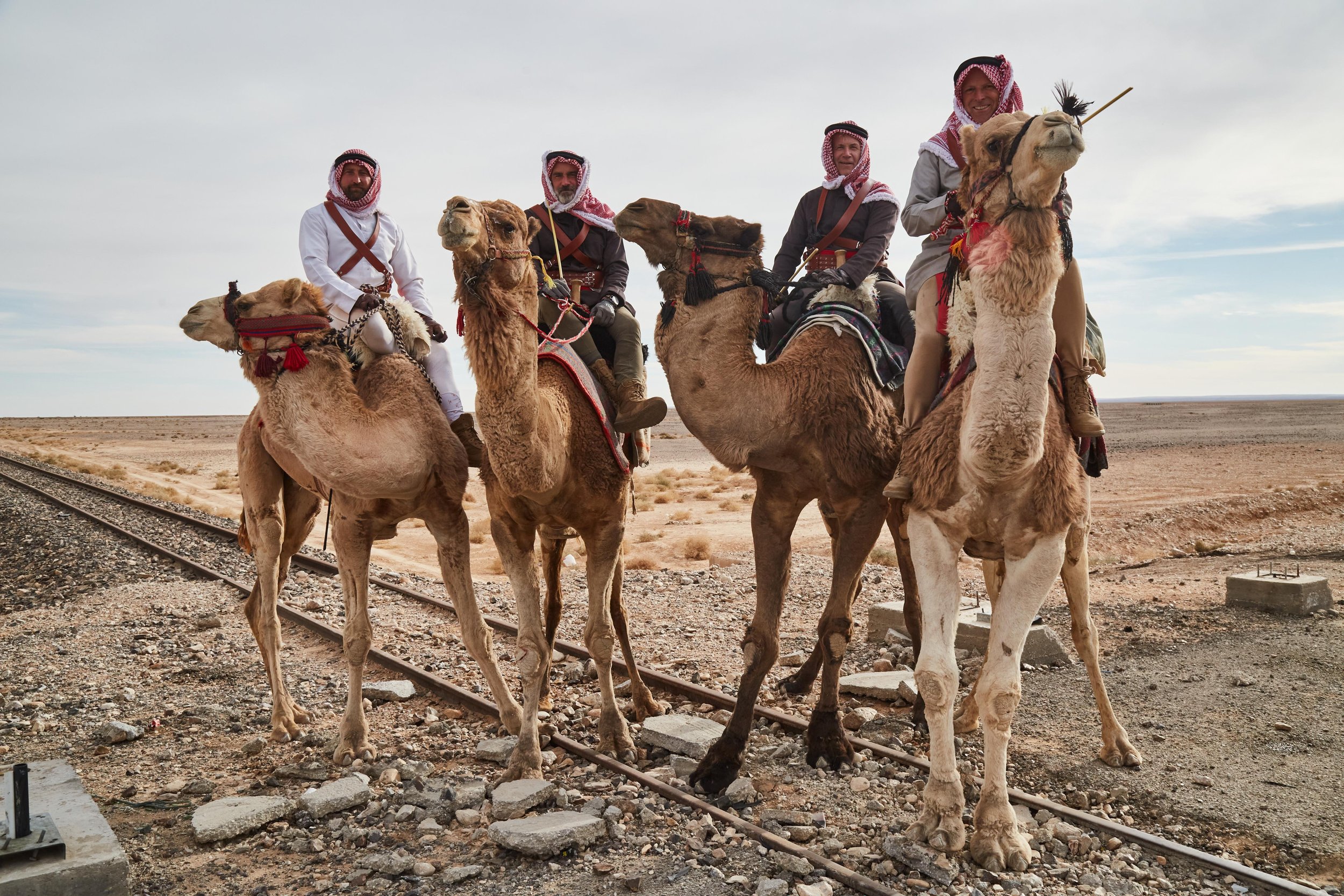
The last time we'd crossed what remained of the Hejaz Railway, we'd been in Saudi Arabia and just about to enter the King Salman Royal Nature Reserve. I had reflected on how sad it was that this historic railway had fallen into complete disrepair and almost into obscurity. However, in Jordan, the opposite was true. The narrow-gauge railway, which had been an engineering feat of determination by the Turks in 1908, had been completely restored and was in use for steam-train tourist excursions. Of course, had we been at Lawrence's party in 1917, we'd have definitely thought about blowing up the line, but for us on this day, the only shooting would be by Henry P and his trusty camera.
We dropped down into a flat basin between the road and some arches that linked the railway embankment a few hundred yards away. James suggested we just cut across, but I knew we needed to intercept the railway close to a small road crossing to get the best photo, so we headed diagonally across the open ground and up the embankment onto the railway line itself. I wasn't sure how the camels would react to treading along the sleepers, but it turned out they didn't mind at all.
Henry was running ahead of us, snapping angles. He ran onto the road and asked us to stop. Unbeknownst to us, he then captured a picture that would become an iconic representation of our trek and would lead to a similar shot being used on the cover of the T.E. Lawrence magazine.
Following the photo shoot, we headed along the small tarmac road until it turned hard south. We then dropped into the bottom of a broad wadi, which was strewn with massive boulders. It was passable on the camels, but I knew the vehicles would need to pick their way through very carefully. So, it was for this reason I'd given Simon two options on where to make camp, whichever he found the easiest to access. He chose the northern option, which was nestled just below some high ground, hence sheltered from wind and close to a lone tree, which we'd used as a marker.
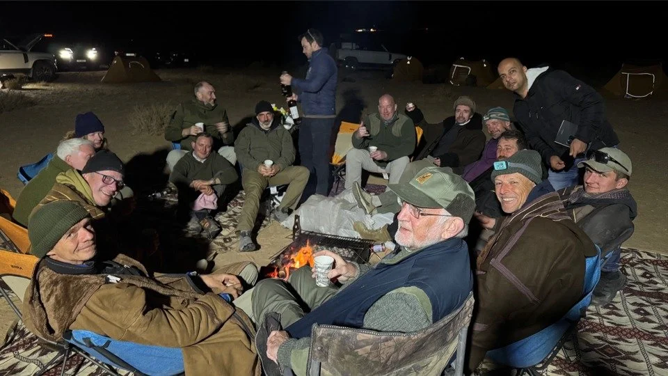
We reached camp in daylight, which was always a plus, and that evening the Team strategised about the next day, which would be a true challenge for riders, camels and vehicles. Everyone was briefed that this would be the toughest day.
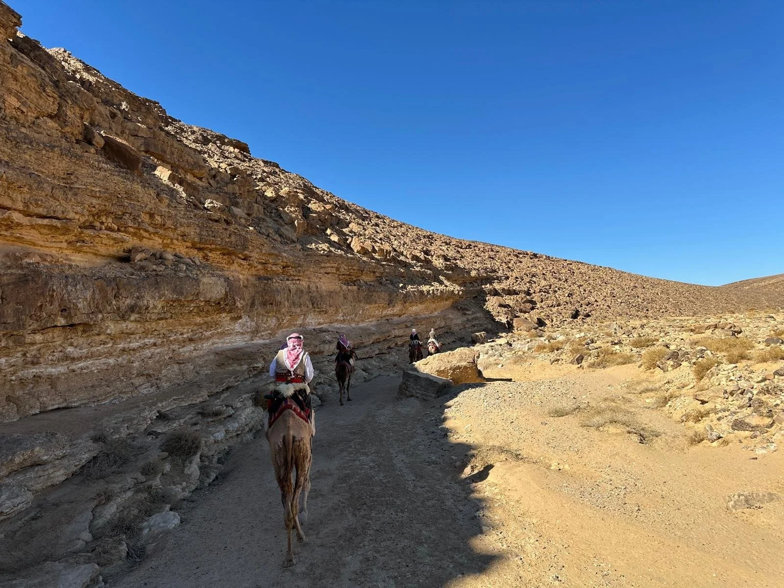
The plan, as we set off the next day, was to cover the flat plain to the foothills as quickly as we could. After a few minutes of riding, which warmed the muscles of camels and riders, we opened the throttle and broke into a fast trot towards the mountains.
It took us about 90 minutes to reach the foothills, which undulated across hidden dips, making the terrain more difficult than it appeared. About 2 hours in, and on a rise, we stopped for a coffee and pee break.
I showed the Bedouin Police riders the map, which showed the only pass through which both camels and vehicles could get. Mishal Abu Tayee explained, in broken English, that there was a better way to the south of that pass, but only the camels could get through. We had a discussion amongst our riders, and it was unanimous that we should go with local knowledge. A member of the Abu Tayee tribe would lead us through the Hejaz, just as Auda Abu Tayi had done for Lawrence 108 years previously.
We mounted up, and the vehicles disappeared to the north. We continued westbound as the undulations grew steeper. Mishal tried to hold high ground whenever he could, but there were many sections where this just wasn't possible. At one point, we came across a pile of stones that was clearly a grave. Clearly, not everyone who attempted this route made it out alive.
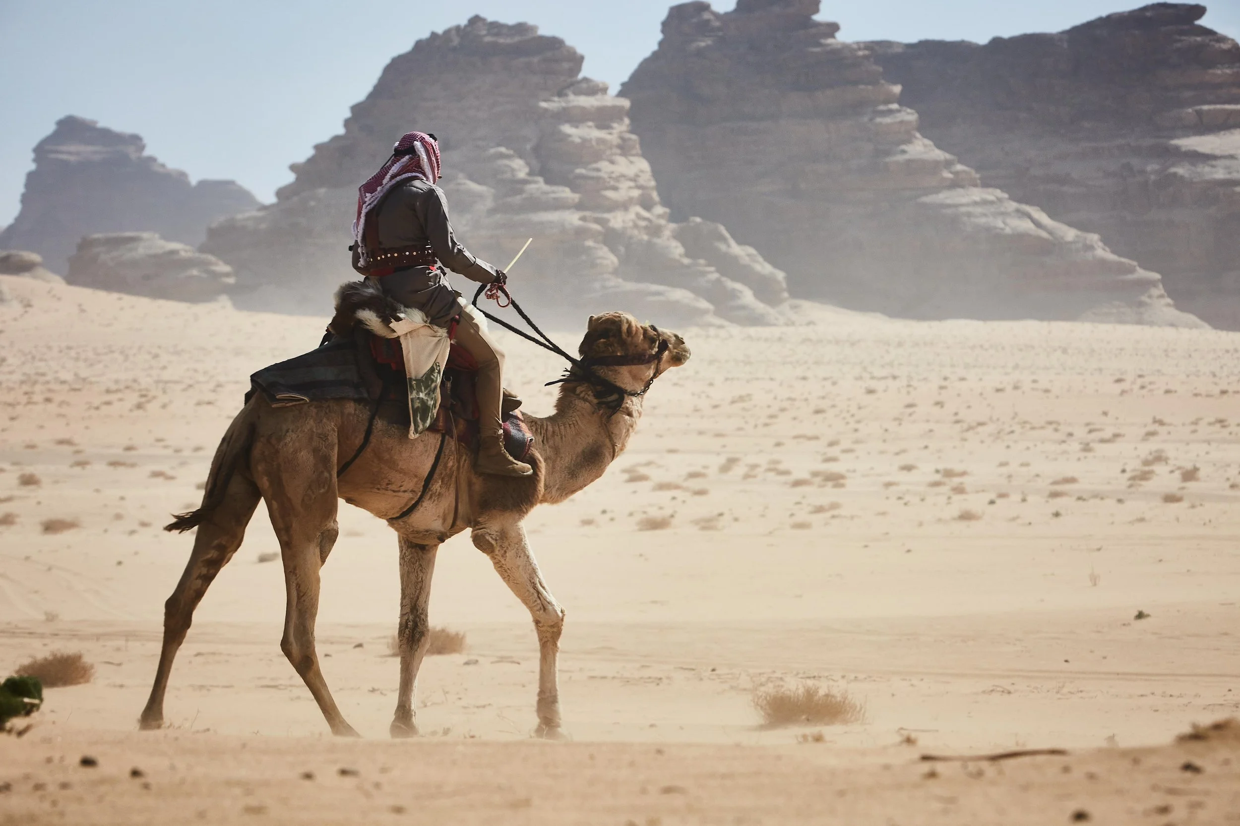
As the ground rose ahead, I thought it would be a continued undulation; I was wrong. We came to a massive chasm with a sheer drop of several hundred feet. I must admit I felt a bit nervous as Shahan stood close to the edge while Mishal explained his plan to Hayal and Falah (the other two Bedouin Police riders). We headed north to a steep valley wall that ran up the re-entrant. I thought the valley wall was way too steep for ride the camels down it, so I assumed he'd either dismount or ride up the re-entrant before backtracking into the chasm, but none of it! He started down the steep valley wall, and we duly followed, and I'd bet each of us was hoping to hell that our camel didn't falter, or worse still, slip and fall.
We picked our way down the steep sides; it was more akin to mountain-goat stuff than anything I thought a camel could manage, but these were, after all, Bedouin Police "Super" Camels. I did, though, feel some sense of relief as we reached the wadi floor. As we did so, we spooked a desert fox, the first and only one we saw in Jordan. The chasm walls towered above us, and we rejoined the westerly route under massive rock overhangs. The terrain gradually climbed at first, then we turned up a steep valley with rock steps almost 1 metre high. We picked our way along, and once again our 4x4 camels managed terrain I'd have never thought possible. Eventually, the ground became less rugged and developed into a gradual climb. In the far distance, we could see a military radar dome. I knew this was the highest point and our marker to the entrance to Wadi Rum, but I wasn't sure if Mishal was planning this route, because as the terrain opened up, he dashed on ahead. We followed, and as we came over a brow, there he was with two of our support Defenders. It was time for another coffee, before a huge climb.
We set off, once again in good spirits, we'd crossed what must be the almost uncrossable, and now we trotted on along a mountain path that was headed towards the radar dome. Mishal picked up the pace as we approached the massive hill. I knew what he was doing: building momentum so that his camel would get itself up the slope before tiring. I went with him, and Shahan tucked himself right in on his tail. As we approached the foot of the climb, one of the Defenders had stopped dead on the path; this would kill our momentum. I squeezed my radio while at a full trot, and probably shouted a little too firmly, "Get out of the way, move now!" The Team in the Defender got the message, and up the climb we went. Shahan was doing really well, staying with Mishal's camel.
As we reached a small part of the climb where the gradient flattened, we slowed to a walk, and Ben J was standing by the Defender, grinning from ear to ear. He said, "I lied to you the other day when I said I'd just had the best day of my life. Today is the best!" As he spoke, and I laughed, I had a small lapse in concentration, and Shahan faltered as if to head back down the mountain. I circled him around, pointed him up the hill again, and used my stick to give him some encouragement. He saw Mishal ahead and went for it. As I glanced back I could see James, but not Tommo or Craig, they must have been with Hayal who would be bringing up the rear.
The gradient steepened again just one last time, as if to throw in more of a challenge, then flattened slightly and turned into a gravel road. As it flattened out, the view to our right was stunning; we could see almost as far as Jafr. On this ridge was a graveyard — obviously a lovely and godly place to be buried.
We waited for the others to catch up, then headed up the road, still climbing, with the radar dome looming large. At the summit, we'd reached 1,800 metres above sea level, and the now metalled road wound along the top of the mountain. We passed an air force military camp, which served the radar. Suddenly, to our left, the ground opened up, and there was a stunning, almost surreal view of Wadi Rum, well over a thousand meters below us and stretching for miles to the south. It was a view so spectacular that it looked more like a picture than reality.
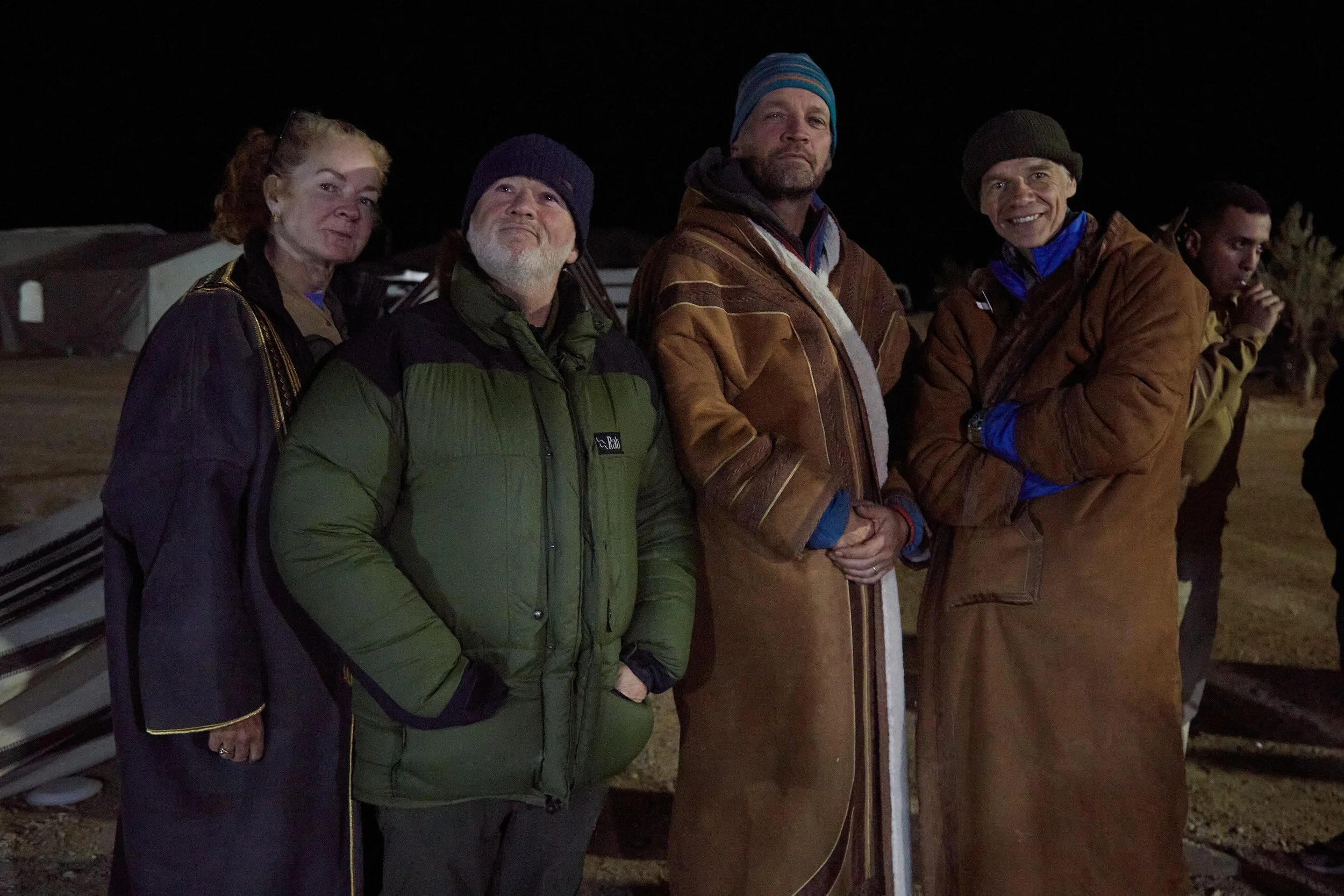
The road started to descend towards the little town of Ras An-Naqab, which I am guessing is one of the world's best-kept secrets when it comes to a village with a view! We passed some kids playing football on the street, and they stopped as we passed by, smiling and waving. We'd also been joined by multiple vehicles and supporters because we were now only a couple of hours' drive from Aqaba.
We joined the old road that would take us south to Wadi Rum and our next camp, which was by now about 10 kilometres away, and all downhill.
In Lawrence's Seven Pillars of Wisdom, he describes their descent into Wadi Rum down a steep zig-zag path, so we left the road and the vehicles and took a path on the side of a precipitous drop that would lead us to it. It was simply too dangerous to ride here, so we dismounted and led our camels down this most historic of trails, with the cobbles of the original path still there in place. Once again, I could feel the spirit of Lawrence and originals, knowing they had trodden these very stones.
Below us, I could see all the vehicles and our supporters with cameras in hand. We zig-zagged our way all the way down, and I think the camels were grateful for their brief respite.
At the base of the hill, we rejoined the road and rode through the town of Dabet Hanut, much to the delight of the children there. At the edge of town, I recognised a familiar figure in Miles G, one of our Trek VPs. We high-fived as I rode by.
At the south of the town, we had only about a kilometre to run, and I was scanning left for the re-entrant where Simon and Rory would have located the camp. It was bang-on and carefully situated so that we were backed up to one of Wadi Rum's towering pillars, but in dead-ground to the road so we could not be seen by passers-by.
The elation on reaching this camp cannot be overstated. What should have been our toughest day had turned out to be the most exhilarating. From here, we'd only have to average about 35 kilometres a day, and all on soft sand or dried-out riverbeds; it was literally all downhill from here.
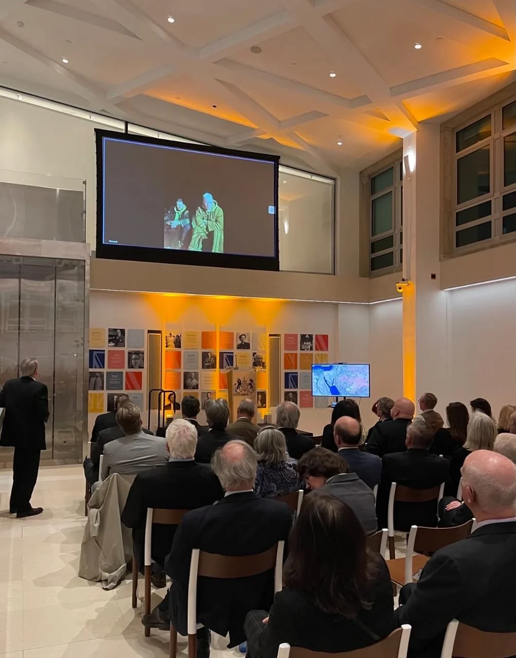
The Team celebrated that night, and there may have been a bit of overindulgence in the liquid gifts brought by our supporters. However, at 3.30am, Tommo and I would have to awaken to have a live link with the British Embassy in Washington, DC, where American Special Forces Club Members were holding a fundraiser on our behalf. The link and the event were a huge success. We then grabbed a couple of hours' sleep before commencing the 6am routine for what would be our last three days.
Tomorrow we would rendezvous with the British Army for lunch, and the following day we would have a train to attack.